Fish Ponds - Big Island, Hawaii
Identification Information
Citation:
Citation Information:
Title:
Fish Ponds - Big Island, Hawaii
Date:
Date: January 25, 2016
Date Type:
creation
(CI_DateTypeCode)
Identifier:
Code:
hi_tnc_bigi_fish_ponds
Authority:
org.pacioos
Responsible Party:
Organization Name:
The Nature Conservancy (TNC) Hawaii
Contact:
Contact Address:
Email:
hawaii@tnc.org
Online Resource:
Linkage: https://www.nature.org/en-us/about-us/where-we-work/united-states/hawaii/
Protocol:
http
Function:
information
(CI_OnLineFunctionCode)
Contact Role:
originator
(CI_RoleCode)
Responsible Party:
Organization Name:
Pacific Islands Ocean Observing System (PacIOOS)
Contact:
Contact Address:
Email:
info@pacioos.org
Online Resource:
Linkage: http://pacioos.org
Protocol:
http
Function:
information
(CI_OnLineFunctionCode)
Contact Role:
publisher
(CI_RoleCode)
Suggested data citation: The Nature Conservancy (TNC) Hawaii. 2016. Fish Ponds - Big Island, Hawaii. Distributed by the Pacific Islands Ocean Observing System (PacIOOS). http://pacioos.org/metadata/hi_tnc_bigi_fish_ponds.html. Accessed [date].
Abstract:
Locations of known and historic fish ponds on the island of Hawaii (Big Island). For some fish ponds, data includes their condition, ownership, and references used to map them.
Purpose:
PacIOOS provides timely, reliable, and accurate ocean information to support a safe, clean, productive ocean and resilient coastal zone in the U.S. Pacific Islands region.
Credit:
The Pacific Islands Ocean Observing System (PacIOOS) is funded through the National Oceanic and Atmospheric Administration (NOAA) as a Regional Association within the U.S. Integrated Ocean Observing System (IOOS). PacIOOS is coordinated by the University of Hawaii School of Ocean and Earth Science and Technology (SOEST).
Point of Contact:
Responsible Party:
Organization Name:
The Nature Conservancy (TNC) Hawaii
Contact:
Contact Address:
Email:
hawaii@tnc.org
Online Resource:
Linkage: https://www.nature.org/en-us/about-us/where-we-work/united-states/hawaii/
Protocol:
http
Function:
information
(CI_OnLineFunctionCode)
Contact Role:
pointOfContact
(CI_RoleCode)
Browse Graphic:
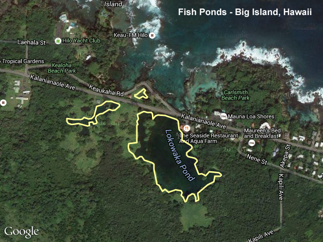
View full image
Image File: http://www.pacioos.hawaii.edu/metadata/browse/hi_tnc_bigi_fish_ponds.png
File Description:
Sample image.
Descriptive Keywords:
Keywords:
Keyword Type:
theme
(MD_KeywordTypeCode)
Keyword: Earth Science Oceans Aquatic Sciences Aquaculture Fish Ponds
Keyword: Earth Science Oceans Aquatic Sciences Fisheries
Keyword Thesaurus:
Citation Information:
Title:
GCMD Science Keywords
Keywords:
Keyword Type:
place
(MD_KeywordTypeCode)
Keyword: Continent North America United States Of America Hawaii
Keyword: Ocean Pacific Ocean Central Pacific Ocean Hawaiian Islands Big Island
Keyword: Ocean Pacific Ocean Central Pacific Ocean Hawaiian Islands Hawaii Island
Keyword Thesaurus:
Citation Information:
Title:
GCMD Location Keywords
Keywords:
Keyword Type:
project
(MD_KeywordTypeCode)
Keyword: PacIOOS Pacific Islands Ocean Observing System
Keyword Thesaurus:
Citation Information:
Title:
GCMD Project Keywords
Keywords:
Keyword Type:
dataCenter
(MD_KeywordTypeCode)
Keyword: PacIOOS Pacific Islands Ocean Observing System
Keyword Thesaurus:
Citation Information:
Title:
GCMD Data Center Keywords
Aggregation Information:
Aggregate Dataset Name:
Citation Information:
Title:
Pacific Islands Ocean Observing System (PacIOOS)
Association Type: largerWorkCitation (DS_AssociationTypeCode)
Initiative Type: project (DS_InitiativeTypeCode)
Resource Constraints:
Legal Constraints:
Use Limitation:
The data may be used and redistributed for free but is not intended for legal use, since it may contain inaccuracies. Neither the data Contributor, University of Hawaii, PacIOOS, NOAA, State of Hawaii nor the United States Government, nor any of their employees or contractors, makes any warranty, express or implied, including warranties of merchantability and fitness for a particular purpose, or assumes any legal liability for the accuracy, completeness, or usefulness, of this information.
Language:
eng
Topic Category:
farming
Extent Information:
Spatial Temporal Extent:
Geographic Element:
Bounding Coordinates:
Westbound Longitude: -156.06169°
Eastbound Longitude: -154.81918°
Southbound Latitude: 18.91393°
Northbound Latitude: 20.20306°
Services:
Service Identification:
Identifier: OGC-WFS
Service Type:
Open Geospatial Consortium Web Feature Service (WFS)
Contains Operation:
Operation Name:
GetCapabilities
Online Resource:
Linkage: http://geo.pacioos.hawaii.edu/geoserver/PACIOOS/hi_tnc_bigi_fish_ponds/ows?service=WFS&version=1.0.0&request=GetCapabilities
Name:
OGC-WFS
Protocol:
OGC:WFS
Description:
Open Geospatial Consortium Web Feature Service (WFS). Supported WFS versions include 1.0.0, 1.1.0, and 2.0.0. Supported output formats include CSV, GeoJSON, GeoJSON-P, GML, KML, and Shapefile (Zipped).
Function:
download
(CI_OnLineFunctionCode)
Services:
Service Identification:
Identifier: OGC-WMS
Service Type:
Open Geospatial Consortium Web Map Service (WMS)
Contains Operation:
Operation Name:
GetCapabilities
Online Resource:
Linkage: http://geo.pacioos.hawaii.edu/geoserver/PACIOOS/hi_tnc_bigi_fish_ponds/ows?service=WMS&version=1.3.0&request=GetCapabilities
Name:
OGC-WMS
Protocol:
OGC:WMS
Description:
Open Geospatial Consortium Web Map Service (WMS). Supported WMS versions include 1.1.1 and 1.3.0. Supported map formats include AtomPub, GeoRSS, GeoTIFF, GIF, JPEG, KML/KMZ, PDF, PNG, SVG, and TIFF. Supported info formats include GeoJSON, GeoJSON-P, GML, HTML, and plain text.
Function:
download
(CI_OnLineFunctionCode)
Services:
Service Identification:
Identifier: OGC-WMS-C
Service Type:
Open Geospatial Consortium Web Map Service - Cached (WMS-C)
Contains Operation:
Operation Name:
GetCapabilities
Online Resource:
Linkage: http://geo.pacioos.hawaii.edu/geoserver/PACIOOS/gwc/service/wms?service=WMS&version=1.1.1&request=GetCapabilities&tiled=true
Name:
OGC-WMS-C
Protocol:
OGC:WMS-C
Description:
Open Geospatial Consortium Web Map Service - Cached (WMS-C). Use of WMS-C is similar to traditional WMS but with the addition of the "tiled=true" parameter, which triggers GeoServer to pull map tiles from GeoWebCache if they have been previously generated. This can dramatically improve performance, especially for larger datasets. Supported map formats include JPEG and PNG. Supported info formats include GeoJSON, GML, HTML, and plain text.
Function:
download
(CI_OnLineFunctionCode)
Back to Top
Data Quality Information
Scope:
dataset
Lineage:
Statement:
2016-01-25T00:00:00Z OGC web services (WMS and WFS) enabled by PacIOOS via GeoServer. Original data from source provider may have been reformatted, reprojected, or adjusted in other ways to optimize these capabilities.
Back to Top
Spatial Representation Information
Content Information
Coverage Description:
Dimensions:
Dimension:
Attribute Name:
aquacultur
Attribute Type:
string
Dimension:
Attribute Name:
area
Attribute Type:
decimal
Dimension:
Attribute Name:
class
Attribute Type:
decimal
Dimension:
Attribute Name:
corialid
Attribute Type:
string
Dimension:
Attribute Name:
dhmfieldch
Attribute Type:
string
Dimension:
Attribute Name:
fishpond_1
Attribute Type:
int
Dimension:
Attribute Name:
fishponds_
Attribute Type:
int
Dimension:
Attribute Name:
geom
Attribute Type:
gml:MultiSurfacePropertyType
Dimension:
Attribute Name:
hiarchsite
Attribute Type:
string
Dimension:
Attribute Name:
hregstat
Attribute Type:
string
Dimension:
Attribute Name:
island
Attribute Type:
string
Dimension:
Attribute Name:
name1
Attribute Type:
string
Dimension:
Attribute Name:
name2
Attribute Type:
string
Dimension:
Attribute Name:
name3
Attribute Type:
string
Dimension:
Attribute Name:
natregstat
Attribute Type:
string
Dimension:
Attribute Name:
ownership
Attribute Type:
string
Dimension:
Attribute Name:
perimeter
Attribute Type:
decimal
Dimension:
Attribute Name:
ref1
Attribute Type:
string
Dimension:
Attribute Name:
ref2
Attribute Type:
string
Dimension:
Attribute Name:
ref3
Attribute Type:
string
Dimension:
Attribute Name:
ref4
Attribute Type:
string
Dimension:
Attribute Name:
ref5
Attribute Type:
string
Dimension:
Attribute Name:
sefactor1
Attribute Type:
string
Dimension:
Attribute Name:
sefactor2
Attribute Type:
string
Dimension:
Attribute Name:
size_
Attribute Type:
decimal
Dimension:
Attribute Name:
source
Attribute Type:
string
Dimension:
Attribute Name:
subsurface
Attribute Type:
string
Dimension:
Attribute Name:
tmk
Attribute Type:
string
Dimension:
Attribute Name:
type_
Attribute Type:
decimal
Dimension:
Attribute Name:
wallcondit
Attribute Type:
string
Dimension:
Attribute Name:
waterquali
Attribute Type:
string
Back to Top
Metadata Reference Information
|
|
